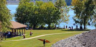
Hiking – Less than 2 hours from Indianapolis
I hiked in each of the 200 counties within 3 hours (210 miles) of Indianapolis during 2020-2021. I’d like to share hikes in 10 of the 60 counties within 110 miles of Indy.
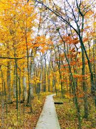
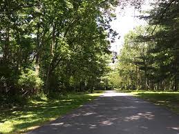
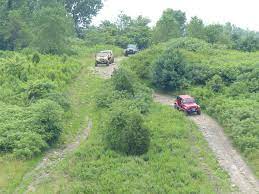
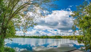
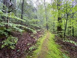
Morgan-Monroe State Forest
Morgan-Monroe State Forest offers a variety of moderately challenging woods and stream valley hikes just an hour southwest of Indy. You might combine this with a hike in Yellowwood State Forest just 30 miles further south.


https://www.in.gov/dnr/forestry/properties/morgan-monroe-state-forest/
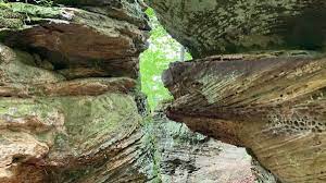
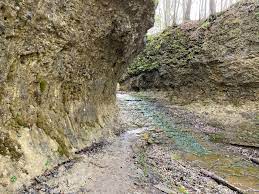
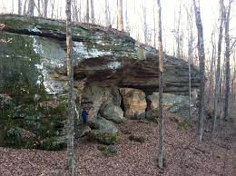
Portland Arch Nature Preserve
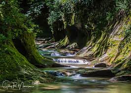
Portland Arch Nature Preserve is less than 90 minutes NW of Indy via I-74 and US 41 near the Illinois border. It features deep stream valleys, cliffs and a small “arch” with a stream running through it. Combine this hike with a visit to 90 foot high Williamsport Falls just 8 miles to the north or Shades State Park 35 miles to the south.


https://www.nature.org/en-us/get-involved/how-to-help/places-we-protect/portland-arch-1/
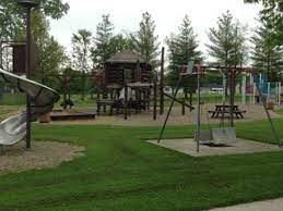
McCloud Nature Park
McCloud Nature Park is 40 miles WNW of Indy. Trails follow the hills and valley of Big Walnut Creek. Combine this with a hike in Big Walnut Nature Preserve 8 miles west, Sugar Creek Nature Park 30 miles NW or Fern Cliff Nature Preserve 30 miles SW.


https://www.visithendrickscounty.com/listings/mccloud-nature-park/186/
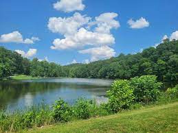
Spring Mill State Park
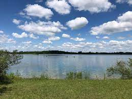
Spring Mill State Park is 90 miles south of Indy, past Bloomington and Bedford via IN-37. This is limestone country. The park features history, steep valleys, hills, forests, lakes and an inn. Combine this with a stop at Cedar Bluffs Nature Preserve 30 miles north or Hardin Ridge Recreation Area on Lake Monroe 30 miles north.


https://www.in.gov/dnr/state-parks/parks-lakes/spring-mill-state-park/
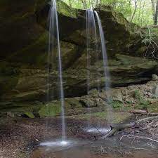
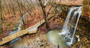
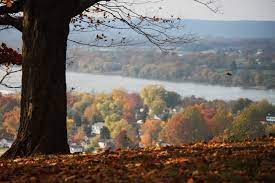
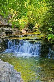
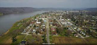
Clifty Falls State Park
Clifty Falls State Park is 90 miles SE of Indy. It features several trails that view waterfalls or rapidly flowing streams that are moving from the standard elevation of SE Indiana down to the Ohio River. Combine this hike with a visit to Madison, IN or Versailles State Park 30 miles north.


https://www.in.gov/dnr/state-parks/parks-lakes/clifty-falls-state-park/
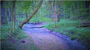
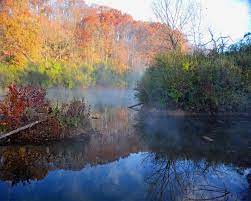
Calli Nature Preserve
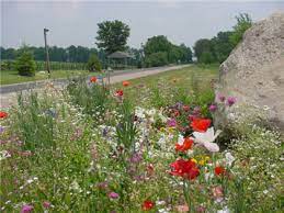
Calli Nature Preserve is located 70 miles southeast of Indianapolis along the Muscatatuck River. The short trail explores a small stream valley and the river valley. It is best visited when Spring wildflowers are in bloom. Combine this hike with a visit to Selmier State Forest just 5 miles north or Muscatatuck National Wildlife Refuge 12 miles to the west.


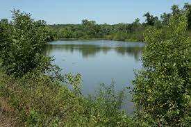
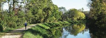
Versailles State Park
Versailles State Park is located 75 miles southeast of Indianapolis. The park features a lake and trails that follow streams/historic roads upland to the east. Combine this hike with a stop at Calli Nature Preserve or Selmier State Forest 20 miles to the west.


https://www.in.gov/dnr/state-parks/parks-lakes/versailles-state-park/
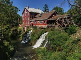
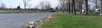
France Park
France Park is located 80 miles north of Indy in the Wabash River Valley. The park features a lake in an old quarry, overlooks, waterfall, a beach and some geological history. Combine this hike with a stop on the Nickel Plate Rail Trail between Peru and Kokomo 25 miles east.


https://visitindiana.com/things-to-do/54745-france-park
Ouabache State Park
Ouabache State Park is located 110 miles northeast of Indy, south of Ft. Wayne, about 30 miles from the start of the Wabash River in Ohio. This is still relatively flat, agricultural Indiana, but the park features pines forests, wetlands, a small lake and a herd of bison. Combine this hike with a stop at the JE Roush Fish and Wildlife Area 25 miles to the NW or the Loblolly Marsh 16 miles south.

https://www.in.gov/dnr/state-parks/parks-lakes/ouabache-state-park/
Kickapoo State Recreation Area (IL)
Kickapoo State Recreation Area is 100 miles NW of Indy, just across the Illinois border. It features trails along the Versailles River in an area that was once only strip mines. Combine this with a visit to the Forest Glen Preserve 20 miles to the south or the Portland Arch 30 miles to the east.


Hiking – About 2 Hours from Indianapolis
I hiked in 200 counties within a 210 mile radius of Indy in 2020-2021. These 10 are my favorites in the roughly 2 hour driving range (110-160 miles) out of 70 counties visited.
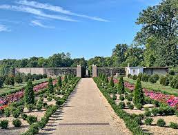
Allerton Park is located 15 miles west of Champaign, IL. The formal gardens are the highlight. Typical central Illinois woods and streams trails are also on the property. Combine this with the Lake of the Woods Forest Preserve and Mabery Gelvin Botanical Gardens in Mahomet, just NW of Champaign.
The Patoka Lake area includes 26,000 acres south of French Lick and east of Jasper, IN. The 6 mile main trail hike to Totem Rock is one highlight in this heavily wooded and rugged part of southern Indiana. The trip down IN-37 from Bloomington to Bedford to Paoli is quite scenic. Then, the fun begins in the most scenic part of the state SW to Patoka Lake. Combine this hike with the Pioneer Mothers Memorial Forest in Paoli.


https://www.in.gov/dnr/state-parks/parks-lakes/patoka-lake/
The Pumpkinvine Trail stretches for 25 miles, connecting the scenic and historic small communities of Goshen, Middlebury and Shipshewana. The trail cuts through these towns and across scenic farming areas. This is Amish Country, east of Elkhart, IN. Combine this with a visit to Chain o Lakes State Park (east) or Potato Creek State Park (west).
Gabis Arboretum is located just west of Valparaiso, IN. The arboretum is built around a small lake and stream. A hiking trail covers this area, a small prairie and a pine woods. The site also contains an outdoor model train with complementary plantings. Indiana Dunes is 20 miles to the north.


Pokagon State Park is in the glaciated “kettle” lakes region of NE Indiana. Hiking trails cover the lake shore, wetlands, streams and small hills. Combine this with a trip to Douglas Woods Nature Preserve 20 miles to the south or Chain o Lakes State Park 45 miles to the SW.


https://www.in.gov/dnr/state-parks/parks-lakes/pokagon-state-parktrine-state-recreation-area/
Jackson-Washington State Forest is located just west of Seymour, IN. It doesn’t get the attention or traffic of Brown County to the northwest or the Hoosier National Forest to the southwest, but it provides the same back woods scenery and changes of elevation found on the Knobstone Trail to the south!

https://www.in.gov/dnr/forestry/properties/jackson-washington-state-forest/
Bernheim Arboretum and Forest is located 25 miles south of Louisville. You’ll see the hills start to grow as you pass the Louisville airport on I-65. This park displays a variety of trees and offers hiking trails around lakes and hills. It also displays “the Giants”, a family of woodland creatures found only here. This is bourbon country, Jim Beam is across the street. Combine this hike with a visit to Yew Dell Botanical Gardens east of Louisville or the Falls of the Ohio State Park in Jeffersonville, OH.


Pyramid Hill Sculpture Park is located 25 miles north of Cincinnati in Hamilton, OH. Hike the roads and trails to visit hundreds of outdoor sculptures. This is a hilly area, so the hiking is good. Combine this with a visit to Mt Airy Park and the Cincinnati Zoo or Twin Creek Park 25 miles NE or Hueston Woods State Park 20 miles to the NW.


Visit John Bryan State Park and Clifton Gorge State Nature Preserve along the scenic Little Miami River 25 miles east of Dayton. The water cuts a true “gorge” through the landscape, quite unexpected in this relatively flat area of central Ohio. Visit Wright-Patterson AFB 14 miles to the west or Charleston Falls 30 miles to the WNW.


https://ohiodnr.gov/wps/portal/gov/odnr/go-and-do/plan-a-visit/find-a-property/john-bryan-state-park
Charleston Falls Preserve is located just 15 miles north of Dayton and east of its airport. The falls is suprisingly large. The stream and woods trails are enjoyable. Pair this with Clifton Gorge or nearby Taylorsville Metro Park.


Hiking: Up to 3 Hours from Indianapolis
I hiked 200 counties within 210 miles (3 hours) of Indianapolis during 2020-21. These 10 were my favorites in the 60 counties more than 160 miles away.
Midewin National Tallgrass Prairie is south of Joliet, IL, not too far from Chicago. It features rolling prairie trails and a heard of bison. One trail features abandoned WWII ammunition shelters. Starved Rock State Park is about 60 miles west along the Illinois River and well worth a visit.


https://www.fs.usda.gov/midewin
Harmonie State Park is 20 miles south of Evansville, IN along the Wabash River before it empties into the Ohio River. It features Wabash River views and surprisingly rugged stream and woods hikes. The historic utopian community of New Harmonie is nearby. John James Audubon State Park is not far away in Henderson, KY.

https://www.in.gov/dnr/state-parks/parks-lakes/harmonie-state-park/
Cove Spring Park is near downtown Frankfort, KY, the state capitol, in the Kentucky River valley. It features stream hikes, a waterfall and steep hill climbs. Buffalo Trace distillery is nearby.

https://www.frankfortparksandrec.com/Parks/Cove_Spring/cove_spring.html
John James Audubon State Park is in Henderson, KY, across the Ohio River from Evansville. It features scenic hikes, historic architecture and a museum featuring John James Audubon’s time in Kentucky and his wildlife art. You could combine this hike with Harmonie State Park or the Patoka River National Wildlife Reserve northeast of Evansville.

https://parks.ky.gov/henderson/parks/historic/john-james-audubon-state-park
Ott Biological Preserve is a surprisingly tranquil spot within Battle Creek, MI. The trails follow streams, valleys and woodlands. Pair this with Fort Custer Recreation Area west of Battler Creek. This part of Michigan has many craft breweries, including Bell’s in Kalamazoo.


https://www.michigan.org/property/ott-biological-preserve
Battelle Darby Creek Metro Park follows it’s namesake west of Columbus, OH. 30 miles of trails in this 7,000 acre park. It has a heard of bison. Consider a stop at Gallagher Fen Nature Preserve about 40 miles west in Springfield, OH just off I-70. Or, head 50 miles north to the Big Darby Headwaters Nature Preserve.

Lawrence Woods State Nature Preserve is 45 minutes north, northwest of Columbus is an area of rolling hills. It features an old growth forest. The highest elevation in Ohio at Campbell Hill (el. 1,550 feet) is nearby in Bellefontaine. Big Darby Headwaters Nature Preserve is 25 miles to the south.

The Highlands Nature Sanctuary is located 75 miles east of Cincinnati in a hilly area that drains south to the Ohio River. Several trails are worth visiting in this area, especially the Barrett’s Rim Trail. Combine this hike with the Great Seal State Park 30 miles to the east. Hocking Hills State Park is considered the Brown County + Hoosier National Forest of southern Ohio. It’s 232 miles from Indy and just 25 miles east of the Great Seal State Park.

https://arcofappalachia.org/highlands-nature-sanctuary/
The Great Seal State Park is located 50 miles south of Columbus, 200 miles east of Indianapolis. Similar to the knobs of the Knobstone Trail, it features a series of hills with ridgetop and stream valley trails that can be seen from a flatter surrounding area. Combine this with Highlands Nature Sanctuary or Hocking Hills.


https://ohiodnr.gov/wps/portal/gov/odnr/go-and-do/plan-a-visit/find-a-property/great-seal-state-park
Providence Metro Park is located southwest of Toledo along the Maumee River and the long abandoned Miami & Erie Canal. The park features a grain mill, river rapids and trails along the towpath. Combine the hike with other segments along the Miami & Erie Canal in Florida, OH (Daylight Falls) and Delphos to St. Mary’s.

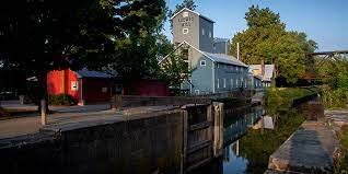
https://metroparkstoledo.com/explore-your-parks/providence-metropark/
Hiking: Off the Beaten Path / Sleepers / Honorable Mention
I hiked in each of the 200 counties within 3 hours (210 miles) of Indianapolis during 2020-21. These 10 locations were not in the top 30, but they deserve “honorable mention” and are surely worth a visit.
Near the Indiana/Illinois border, SE of Kankakee is a sand based savannah with unique vegetation.

https://www2.illinois.gov/dnr/INPC/Pages/Area3IroquoisHooperBranchSavanna.aspx
Far south within the Hoosier National Forest is a nature preserve with a challenging hike up a stream valley, stream bed ending at two small waterfalls from the cliffs of this valley.

https://www.crawfordcountyindiana.com/attractions/park-scenic/yellow-birch-ravine/
Near the Indiana/Michigan border, part of the South Bend parks system is a kettle lake of true beauty. There is a boardwalk into the lake and other trails in the glaciated area.

http://www.sjcparks.org/591/Spicer-Lake
The Hoosier National Forest has dozens of strong hiking options. The Pioneer Mothers Memorial is located just outside of Paoli, IN (yes, Paoli Peaks skiing area). Stunning old growth forest. Easy 1 mile out and 1 mile back trail.

https://www.fs.usda.gov/recarea/hoosier/recarea/?recid=41586
Fall Creek Gorge is a nature preserve hike down a stony creek north of Covington, IN near the Illinois border. It is now closed.

https://www.nature.org/en-us/get-involved/how-to-help/places-we-protect/fall-creek-gorge/
Nearby Williamsport Falls is a worthy substitute.

https://en.wikipedia.org/wiki/Williamsport_Falls
Boone County Arboretum is a very well laid out facility 20 miles south of the Cincinnati airport.

Devou Park is a community park in Covington, KY with amazing views of the Ohio River valley and Cincinnati.

https://www.exploredevoupark.org/?gclid=EAIaIQobChMI8rCOtIGN9AIVlmxvBB2vBQ1DEAAYASAAEgLCcvD_BwE
Yew Dell Botanical Gardens is another Kentucky arboretum, east of Louisville.
Cedar Line Nature Preserve is just 30 south/southeast of Cincinnati, but it is “worlds away”. The drive through steeply ravined hills near the Ohio River is as enjoyable as the remote feeling hike.
https://pendletoncounty.ky.gov/Pages/CedarLineNaturePreserve.aspx
Springfield, OH, midway between Dayton and Columbus, OH is noted for Wittenberg University, childhood home of John Legend and … Gallagher Fen State Nature Preserve. A fen is a special type of wetland.

Hiking – East North East Indiana
This area is mostly flat, with a few smaller river valleys and many well-maintained rail-trails.
2 mile paved trail from Blackford HS, east or Marion, IN.

https://www.facebook.com/Blackford-Greenway-Inc-140018430028350/
Follow the Cardinal Greenway from Richmond, IN to Losantville to Muncie to Gas City to Marion. 60 miles of gently rolling terrain on a rail-trail, part of the American Discovery Trail.


https://www.indianatrails.com/cardinal-greenway
Rail trail west of Marion, IN.
Heavily used rail-trail in Hamilton County, north of Indianapolis.
https://www.visithamiltoncounty.com/things-to-do/outdoors/monon-trail/
Rail-trail west of Indianapolis.

https://www.greenfieldin.org/component/content/article/107-content/170-pennsy
Impounded lake with trails south of Muncie, IN.
https://www.in.gov/dnr/state-parks/parks-lakes/summit-lake-state-park/
Rail-trail beginning in Kokomo, IN by the Wildcat Creek.
http://www.nickelplatetrail.org/
Wetlands area north of Portland, IN.
Hiking along the White River plus Indian mounds near Anderson, IN.


https://www.in.gov/dnr/state-parks/parks-lakes/mounds-state-park/
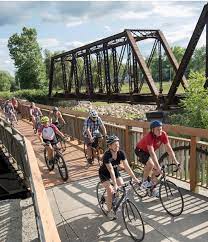
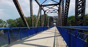
Highly used rail-trail for 10 miles in Indianapolis.

https://www.visitindy.com/indianapolis-monon-rail-trail
Explore the streets and rail tracks of this small town north of Indianapolis.

Hiking – East Central Illinois
This relatively flat section of Illinois contains several river areas with attractive hiking trails.
Forest preserve and attractive botanical garden NW of Champaign, IL.
https://www.ccfpd.org/lake-of-the-woods-mahomet-illinois
Lake, farm, prairie and stream trails north of Decatur, IL.
https://www2.illinois.gov/dnr/Parks/Pages/WeldonSprings.aspx
5 miles of scenic trails west of Lake Charleston.
Click to access Trail_Map_2.1(1).pdf
Relatively steep ravine trails at an impounded lake NW of Terre Haute, IN.
https://www2.illinois.gov/dnr/Parks/Pages/WalnutPoint.aspx
Community park in Paris, IL, NW of Terre Haute, IN.

Community park SW of Bloomington, IL.
https://destinationlogancountyil.com/kickapoo-creek-park
Old growth woods, SE of Decatur, IL.
https://www2.illinois.gov/dnr/Parks/Pages/SpitlerWoods.aspx
Beautiful formal gardens and trails west of Champaign, IL.

Variety of trails in a reclaimed surface mining area along the Vermilion River, west of Danville, IL
https://www2.illinois.gov/dnr/Parks/Pages/Kickapoo.aspx
Walk the country roads of this river valley area, west of Mattoon, IL.
https://en.wikipedia.org/wiki/Kaskaskia_River_State_Fish_and_Wildlife_Area
Camping trails along impounded Lake Shelbyville, SE of Decatur, IL.

Hiking – SW Indiana
From the Wabash River to Patoka River/Lake to the Hoosier National Forest, scenic trails and preserves abound.
Hike the central road of Dogwood Lake at Glendale FWA, SE of Washington, IN.
https://www.in.gov/dnr/fish-and-wildlife/properties/glendale-fwa/
The 6 mile main trail is rugged, providing a view of Totem Rock. Patoka Lake is south of French
Lick, IN.
https://www.in.gov/dnr/state-parks/parks-lakes/patoka-lake/
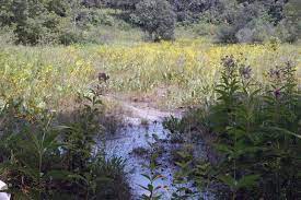
The Snakey Point Marsh offers trails and road hikes in Patoka River Wildlife Refuge, north of Evansville.
Spring Mill State Park, south of Bedford, IN, is one of the largest Indiana State Parks with an inn and extensive hilly, wooded hiking trails.


https://www.in.gov/dnr/state-parks/parks-lakes/spring-mill-state-park/
Southwest of Bedford, IN, adjacent to Hoosier National Forest, Martin State Forest offers a variety of moderate to challenging hikes in the forested hills.
https://www.in.gov/dnr/forestry/properties/martin-state-forest/
1 mile old growth forest trail south of Bedford, IN. (Pioneer Mothers Memorial)

https://www.fs.usda.gov/recarea/hoosier/recarea/?recid=41586
Tipsaw Trail is 6 miles long in rugged country near Tipsaw Lake in the southern Hoosier National Forest, 20 miles north of the Ohio River.
https://www.fs.usda.gov/recarea/hoosier/recarea/?recid=41500
West of Jasper, IN, Pike State Forest encompasses the bottomlands of the Patoka River and small hills.

https://www.in.gov/dnr/forestry/properties/pike-state-forest/
South of Evansville on the banks of the Wabash River, Harmonie State Park offers moderately rugged woods hiking.
https://www.in.gov/dnr/state-parks/parks-lakes/harmonie-state-park/
South of Jasper, IN, Lincoln State Park offers 10 miles of hiking trails in varied areas.
https://www.in.gov/dnr/state-parks/parks-lakes/lincoln-state-park/
Short hike in community park and adjacent neighborhoods in Evansville.

https://www.visitevansville.com/sports/price-park
Challenging hike through creek bottoms and steep cliffs, west of Louisville.
https://www.crawfordcountyindiana.com/attractions/park-scenic/yellow-birch-ravine/
Off-road vehicle park, with some trails open to hikers on this formerly strip-mined site. Northeast of Evansville.
https://www.in.gov/dnr/outdoor-recreation/properties/interlake-state-recreation-area/
Vincennes community park with Wabash River and woods trails.
Hiking – West Central Ohio
2 miles of forest trails west of Lima, OH.
Sections of the Miami & Erie Canal towpath are open for hiking. The area from St. Mary’s north is attractive.
http://www.htparks.org/the-towpath-trail
Small impounded lake northeast from Dayton. A little more rolling hills than expected.
https://ohiodnr.gov/wps/portal/gov/odnr/go-and-do/plan-a-visit/find-a-property/kiser-lake-state-park
Short hike in a unique environment that feels like you’re surrounded.
5 miles of trails at this mid-sized impounded lake. The view of the spillover to the west is interesting.
https://ohiodnr.gov/wps/portal/gov/odnr/go-and-do/plan-a-visit/find-a-property/buck-creek-state-park
2 miles of varied prairie, wetland and farm trails northwest from Dayton. A historic log house is featured.
http://www.darkecountyparks.org/shawnee-prairie-preserve-nature-center
Moderately challenging horse trails west of a large impounded lake, north of Columbus.

https://ohiodnr.gov/wps/portal/gov/odnr/go-and-do/plan-a-visit/find-a-property/alum-creek-state-park
Large park system with many attractive hiking options west of Columbus.

1 mile of old growth forest trail east of Lima, OH.
Hike the lakeshore of this highly commercialized natural lake north of Dayton.
1 mile trail at small impounded lake west of Columbus.
Short trails in a community park adjacent to the historic Ft. Recovery, north of Richmond, IN.
https://www.fortrecovery.org/ambassador-park
Waterfalls hike near Dayton.
https://www.miamicountyparks.com/parks/charleston
Short trails at an impounded lake north of Dayton.
2+ miles of trails in a diverse nature preserve northwest from Columbus.

Hiking – North Central Kentucky
Rolling hills, Ohio River views, lakes, forests and small towns east of Louisville.
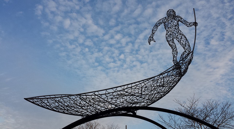
Privately owned sculpture park in a rolling hills setting.
https://josephinesculpturepark.org/
Short (moderately challenging) hiking trails at this historic lodge sight, NE of Louisville high above the Ohio River.
https://parks.ky.gov/carrollton/parks/historic/general-butler-state-resort-park
Series of stream valley and highlands trails in Frankfurt, KY.

https://www.frankfortparksandrec.com/Parks/Cove_Spring/cove_spring.html
Historic Ohio River town, SE of Cincinnati.
https://www.cityofwarsawky.org/index.html
Short river valley walk in a community park.
Walk historic Main Street with the railroad tracks and Wilborn Park in LaGrange, NE of Louisville.

https://www.lagrangeky.net/parks.html
Moderately rugged hiking in this nature preserve east of Elizabethtown, KY.
https://eec.ky.gov/Nature-Preserves/Locations/Pages/Vernon-Douglas.aspx
Walk Main Street, residential neighborhoods and this state park in historic Harrodsburg, KY.

https://parks.ky.gov/harrodsburg/parks/historic/old-fort-harrod-state-park
Hike the trails around this community park/fairground in a scenic area midway between Louisville and Cincinnati.
https://www.owencountyky.us/parks-rec
Higher traffic, series of developed trails just east of metro Louisville.
Extensive multi-purpose trail system around an impounded lake SE of Louisville.
https://parks.ky.gov/mount-eden/parks/recreation/taylorsville-lake-state-park
Small cemetery overlooking Ohio River across from Madison, IN.
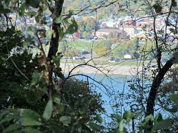
https://www.findagrave.com/cemetery/75156/moffett-cemetery
Visit the museum and walk the disc golf course an hour SE of Louisville in scenic area.
https://parks.ky.gov/springfield/parks/historic/lincoln-homestead-state-park
